A. Required documents. Prior to issuance of a certificate of completeness, the Site Plan Committee shall determine that the following has been submitted in proper form. The Site Plan Committee may recommend a preliminary plat of a major site plan for public hearing upon submission of the items in Subsection A(1) through (8):
(1) The Borough Engineer's report.
(2) A copy of the application for granting of a CAFRA permit, where required and if submitted.
(3) An application for a New Jersey Department of Environmental Protection wetlands permit, where required.
(4) Other submittals that may be required by the Borough Engineer, Planning Board, Board of Adjustment or federal, state, county or local law.
(5) A request for the granting of any variances required.
(6) Required application fees as set forth in § 94-3.14 of this chapter.
(7) Thirty-three (33) copies of a plat and attachments meeting the requirements set forth below. [Amended 12-13-1993 by Ord. No. 6701
(8) Thirty-three (33) copies of a completed application form. [Amended 12-13-1993 by Ord. No. 670]
(9) Proof of service of notice in conformance with § 94-3.3D of this chapter.
(1) General requirements.
(a) Any preliminary plat of a major site plan presented to the Planning Board or Board of Adjustment for its approval shall be signed and appropriately sealed by an architect, professional engineer, land surveyor and/or professional planner licensed to practice in the State of New Jersey; provided, however, that sanitary sewer, water distribution and storm drainage plans and water and sewage treatment plans may only be signed for and sealed by a professional engineer.
(b) Site plans shall not be drawn at a scale larger than one (1) inch equals thirty (30) feet nor larger than one (1) inch equals ten (10) feet. If the size of the site would require the use of sheets larger than thirty by forty-two (30 x 42) inches in order to show the entire site on one (1) sheet, the detailed information for the site plan shall be shown on sheets no larger than thirty by forty-two (30 x 42) inches, which sheets shall be keyed to an overall plan of the site drawn at a scale of not less than one (1) inch equals twenty (20) feet. [Amended 12-13-1993 by Ord. No. 670]
(c) The site plan shall be based on a current certified boundary survey. The date of the survey and the name of the person making the same shall be shown on the map. [Amended 12-13-1993 by Ord. No. 670]
(2) Title block. The title block shall appear on all sheets and include:
(b) The name of the development, if any.
(c) The Tax Map sheet, block and lot number of the site, as shown on the latest Borough Tax Map, the date of which should also be shown.
(d) The date of the original and all revisions.
(e) The names and addresses of the owner and developer so designated.
(f) The names, signatures, addresses and license numbers of the engineer, architect, land surveyor or planner who prepared the plan and their embossed seal(s).
(g) If the site plan contains more than one (1) sheet, each shall be numbered and titled.
(3) A schedule shall be placed on the site plan indicating:
(a) The acreage of the tract and site (the portion of the tract involved in the site plan).
(b) The floor area of the existing and proposed buildings (listed separately).
(c) The proposed use or uses and the floor area devoted to each use.
(e) The proposed and required lot dimensions and front, rear and side setbacks.
(f) The proposed and required off-street parking spaces.
(g) The square footage and percentage of the site retained in unoccupied open space and occupied by buildings.
(4) The North arrow and written and graphic scales.
(5) The tops of the banks and boundaries of the floodways and flood hazard areas of all existing watercourses, where such have been delineated or the limits of alluvial soils where the boundaries of floodways and flood hazard areas have not been determined, and/or such other information as may assist the Board in the determination of floodway and flood hazard area limits.
(6) Paving and right-of-way widths of existing streets within two hundred (200) feet of the site.
(7) The boundary, nature and extent of wooded areas, swamps, bogs and ponds within the site and within two hundred (200) feet thereof.
(8) Existing and proposed manholes, sewer lines, fire hydrants, waterlines, utility poles and all other topographical features of a physical or engineering nature within the site and within two hundred (200) feet thereof.
(9) All existing structures on the site and within two hundred (200) feet thereof, including their use, indicating those to be destroyed or removed and those to remain.
(10) The location, use, finished grade level, ground coverage, first floor and basement elevations, front, rear and side setbacks of all existing buildings and other pertinent improvements.
(11) Existing and proposed public easements or rights-of-way and the purposes thereof.
(12) A grading plan showing existing and proposed grading contours at one-foot intervals throughout the tract, except that if slopes exceed five percent (5%), a two-foot interval may be used, and if they exceed ten percent (10%), a five foot interval is permissible. Datum shall be United States Coast and Geodetic Survey datum (MSL=O) and the source of datum shall be noted. In addition to proposed grading contours, sufficient additional spot elevations shall be shown to clearly delineate proposed grading.
(a) The drainage plan shall be presented in graphic form which shall clearly show the street and lot layout and those items which are pertinent to drainage, including existing and proposed contours as previously required.
(b) The plan shall outline each area contributing to each inlet.
(c) All proposed drainage shall be shown with pipe type and sizes, invert and grate or rim elevations, grades and direction of flow. The direction of flow of all surface waters and of all streams shall be shown.
(d) The drainage plan shall be accompanied by complete drainage calculations made in accordance with the standards set forth in this chapter.
(14) Off-site drainage plan. The plat shall also be accompanied by an off-site drainage plan prepared in accordance with the following standards:
(a) The plan shall consist of an outline of the entire drainage basin in which the site is located. The terminus of the basin and existing ground contours or other basis for determining basin limits shall be shown.
(b) The pertinent off-site existing drainage shall be shown with elevations of inverts and grates to the nearest one-tenth (0.1) of a foot.
(c) To the extent that information is available and may be obtained from the County or Municipal Engineer(s), any existing plans for drainage improvements shall be shown.
(d) In the event that a temporary drainage system is proposed, full plans of that system shall be shown.
(e) The off-site drainage plans shall be accomplished by profiles of all proposed drainage, showing existing details, pipe sizes, types, inverts, crowns, slopes; all proposed structures and connections; and design hydraulic grade lines for all conduits designed to carry forty (40) or more cubic feet per second. Cross sections at intervals not exceeding one hundred (100) feet shall be shown for all open channels.
(15) If required by the municipal agency, center-line profiles of streets bordering the site, internal roadways and major circulation aisles showing(a) Existing and proposed final grades and slopes.
(b) Pipe sizes, slope, types, inverts and grate or rim elevation of drainage and sanitary sewerage facilities.
(16) Boring logs. Unless the municipal agency shall determine that fewer boring logs are required or that some or all of the boring logs may be deferred to the final plat stage, the site plan shall be accompanied by a set of boring logs and soil analyses for borings made in accordance with the following requirements:
(a) Borings shall be taken between January 1 and April 30 and spaced evenly throughout the site.
(b) One (1) boring not less than fifteen (15) feet below grade or twenty (20) feet minimum depth shall be made for every five (5) acres, or portion thereof, of land where the water table is found to be ten (10) feet or more below proposed or existing grade at all boring locations.
(c) One (1) additional boring shall be made per acre, or portion thereof, in those areas where the water table is found to be less than ten (10) feet below proposed or existing grade.
(d) In addition to the above, in those areas where the water table is found to be five (5) feet or less below existing or proposed grade, two (2) additional borings per acre, or portion thereof, will be required if construction of basements is contemplated. Borings shall be located where such basements are proposed.
(e) Boring logs shall show soil types and characteristics encountered, groundwater depths, the methods and equipment used, the name of the firm, if any, making the borings and the name of the person in charge of the boring operation. The boring logs shall also show surface elevations to the nearest one-tenth (0.1) of a foot.
(f) Based on the borings. the site plan shall clearly indicate all areas having a water table within two (2) feet of the existing surface of the land, or within two
(2) feet of proposed grade, or all areas within which two (2) feet or more of fill is contemplated or has previously been placed.
(17) Zone district boundaries and the Tax Map sheet, lot and block numbers and names of owners of all properties within two hundred (200) feet of the site.
(18) A key map, at a scale of not less than one (1) inch equals one thousand (1,000) feet, showing the location of the site with reference to surrounding areas, existing streets, the names of all such streets and any zone district boundary or municipal boundary which is within five hundred (500) feet of the subdivision.
(19) The location, area, dimensions and proposed disposition of any area or areas of the site proposed to be retained as common open space, indicating the facilities to be provided in such areas.
(20) The capacity of off-street parking areas and the location and dimensions of all access drives, aisles and parking stalls. The location and treatment of existing and proposed entrances and exits to public rights- of-way, including the possible utilization of traffic signals, channelization, acceleration and deceleration lanes, additional width and any other device necessary for traffic safety and/or convenience and the estimated average number of passenger vehicles, single-unit trucks or buses, and semitrailers that will enter the site each day.
(21) Graphic depiction of the anticipated routes and details of the system of on-site vehicular and pedestrian circulation. If the developer desires to have the appropriate provisions of N.J.S.A. 39:1-1 et seq. governing motor vehicle operation made applicable to the site, thereby allowing municipal police regulation of traffic control devices, he shall submit a formal request and a detailed plan meeting the requirements of the New Jersey Department of Transportation. The Borough Engineer will advise the developer regarding the details of such a plan.
(22) The location and size of proposed loading docks.
(23) The location of curbs and sidewalks.
(24) Cross sections showing the composition of pavement areas, curbs and sidewalks.
(25) An exterior lighting plan, including the location, direction of illumination, amount of illumination expressed in horizontal footcandles, wattage and drawn details of all outdoor lighting standards and fixtures.
(26) Landscaping and screening plan showing the location, type, spacing and number of each type of tree or shrub, the location, type and amount of each type of ground cover to be utilized and a plant list and planting details for trees, shrubs and/or ground cover.
(27) Location of signs and drawn details showing the size, nature of the construction, height and content of all signs.
(28) Drawn details of the type of screening to be utilized for refuse storage areas, outdoor equipment and bulk storage areas.
(29) Floor plans and building elevation drawings of any proposed structure or structures or existing structures to be renovated.
(30) The location of handicapped facilities, including parking spaces and ramps, where applicable.
(31) If the Board of Adjustment, Planning Board, Shade Tree Commission or Environmental Commission determines that existing trees located on the site may have an effect on the proper layout of the site, it may be required that the location, caliper and type be shown on the plat for the following:
(a) Living deciduous trees having a trunk diameter of four (4) inches or more at breast height.
(b) All living coniferous trees having a trunk of four (4) inches or more in diameter at breast height.
(c) All living dogwood (Cornus florida) or American holly (Ilex opaca) trees having a trunk of one (1) inch or greater at breast height.
(d) All native laurel (Kalmia latifolia) shrubs having a root crown of three (3) inches or greater measured at the soil or surface level.
(32) Sectionalization and staging plan. Developers of large uses, such as shopping centers, industrial parks or other such uses proposed to be developed in stages, shall submit a sectionalization and staging plan showing the following(a) The anticipated date for commencing construction of each section or stage. The staging of development on the site shall be such that if development of the site were discontinued after the completion of any stage, the developed portion of the site would comply in all respects to the requirements of this chapter and be provided with adequate drainage and utility systems.
(b) Those improvements that will be completed in each stage prior to application for a certificate of occupancy. The plan should demonstrate that the staging of construction will minimize adverse effects upon occupied buildings in the site and adjoining properties.
(33) A written description of the proposed operations in sufficient detail to indicate the effects of the use in producing traffic congestion, noise, glare, air pollution, fire hazards or safety hazards. The written description shall also include the hours of operation of the use, the number of shifts to be worked, the number of employees in each shift, the number of vehicles to be stored or parked on the site and provisions to be made for site maintenance.
(34) Such other information as the municipal agency and/or Borough Engineer may request during site plan review.
C. Conditions of approval.
(1) Any approval of an application for development for a preliminary plat of a major site plan by the Planning Board or Board of Adjustment shall be subject to the following conditions being satisfied prior to the signing of the plat:
(a) Submission of additional prints of the plat and attachments for distribution, if required.
(b) Preliminary Monmouth County Planning Board approval, if not previously granted.
(c) Tentative Northeast Monmouth County Regional Sewerage Authority approval, if not previously granted.
(d) Publication of a notice of the decision of the Board by the administrative officer (Planning Board or Board of Adjustment Secretary) in accordance with § 94-3.3E of this chapter.
(e) Any other conditions which may be imposed by the Board or may be required by federal, state, county or municipal law.
(2) The Board may also condition its preliminary approval upon the applicant providing for certain revisions or additions on the final plat submission.
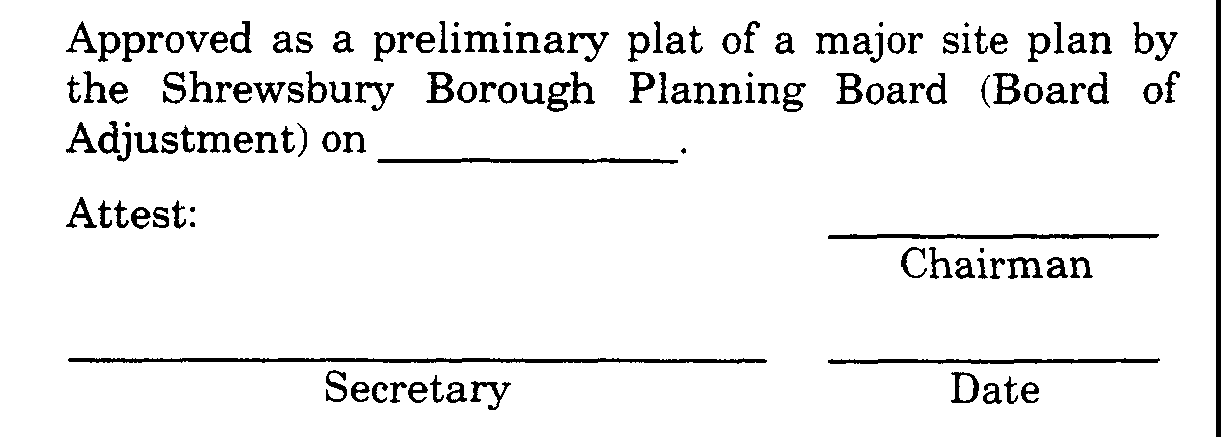
D. Certification. In the event that the application for development for a preliminary plat of a major subdivision is approved, a certification to that effect in the following form shall be endorsed on the preliminary plat and the original reproducible thereof shall be provided to the Board by the applicant. Said original shall be signed by the Chairman and Secretary of the municipal agency after they receive certification from the administrative officer (Planning Board or Board of Adjustment Secretary) that all conditions of approval have been satisfied. After signature, the preliminary plat shall be reproduced as provided for in § 94-6.4G of this chapter, and the signed original shall be returned to the applicant.