
E. Time limits for approval. Upon the submission to the administrative officer (Planning Board or Board of Adjustment Secretary) of a complete application for a site plan which involves ten (10) acres of land or less and ten (10) dwelling units or less, the Planning Board shall grant or deny preliminary approval within forty-five (45) days of the date of such submission or within such further time as may be consented to by the developer. Upon submission of a complete application for a site plan which involves more than ten (10) acres or more than ten
(10) dwelling units, the Planning Board shall grant or deny preliminary approval within ninety-five (95) days of the date of such submission or within such further time as may be consented to by the developer. Otherwise, the Planning Board shall be deemed to have granted preliminary approval of the site plan.
F. Effects of preliminary approval.
(1) [Amended 12-13-1993 by Ord. No. 670] Preliminary approval of a major site plan pursuant to N.J.S.A 40:55D-46 shall, except as otherwise provided herein, confer upon the applicant the following rights for a three-year period from the date on which the resolution of preliminary approval is adopted:
(a) That the general terms and conditions on which preliminary approval was granted shall not be changed, including but not limited to use requirements; layout and design standards for streets, curbs and sidewalks, lot size, yard dimensions and off-tract improvements; and any requirements peculiar to site plan approval pursuant to N.J.S.A. 40:55D-41, except that nothing herein shall be construed to prevent the borough from modifying by ordinance such general terms and conditions of preliminary approval as relate to public health and safety.
(b) That the applicant may submit for final approval on or before the expiration date of preliminary approval the whole or a section or sections of the preliminary site plan.
(c) That the applicant may apply for and the Planning Board may grant extensions of such preliminary approval for additional periods of at least one (1) year, but not to exceed a total extension of two (2) years, provided that if the design standards have been revised by ordinance, such revised standards shall govern.
(2) In the case of a site plan for an area of fifty (50) acres or more, the Planning Board may grant the rights referred to in Subsection F(1)(a), (b) and (c) above for such period of time, longer than three (3) years, as shall be determined by the Planning Board to be reasonable, taking into consideration the number of dwelling units and nonresidential floor area permissible under preliminary approval, economic conditions and the comprehensiveness of the development. The applicant may apply for thereafter and the Planning Board may thereafter grant an extension to preliminary approval for such additional period of time as shall be determined by the Planning Board to be reasonable, taking into consideration the number of dwelling units and nonresidential floor area permissible under preliminary approval; the potential number of dwelling units and nonresidential floor area permissible under preliminary approval; the potential number of dwelling units and nonresidential floor area of the section or sections awaiting final approval; economic conditions; and the comprehensiveness of the development, provided that if the design standards have been revised, such revised standards shall govern. Approval of a preliminary plat shall confer upon the applicant all the rights set forth in N.J.S.A. 40:55D-49.
(3) Whenever the Planning Board grants an extension of preliminary approval pursuant to Subsection F(1)(c) or (2) above and preliminary approval has expired before the date on which the extension is granted, the extension shall begin on what would otherwise be the expiration date. The developer may would otherwise be the expiration date. [Added 12-13-1993 by Ord. No. 670]
(4) The Planning Board shall grant an extension of preliminary approval for a period determined by the Board but not exceeding one (1) year from what would otherwise be the expiration date if the developer proves to the reasonable satisfaction of the Board that the developer was barred or prevented, directly or indirectly, from proceeding with the development because of delays in obtaining legally required approvals from other governmental entities and that the developer applied promptly for and diligently pursued the required approvals. A developer shall apply for the extension before what would otherwise be the expiration date of the preliminary approval or the 91st day after the developer receives the last legally required approval from other governmental entities, whichever occurs later. An extension granted pursuant to this subsection shall not preclude the Planning Board from granting an extension pursuant to Subsection F(1)(c) or (2). [Added 12- 13-1993 by Ord. No. 670]
G. Improvements not to be installed. Approval of a preliminary plat shall not confer upon the developer the right to undertake any clearing, grading and/or to install any improvements prior to final plat approval unless it shall be determined by the Planning Board or Board of Adjustment and the Borough Engineer that said clearing, grading and/or installation of improvements would not hinder future development or create physical or aesthetic problems in the event that further development of the site plan is not undertaken and that required inspection fees have been paid and adequate performance guaranties have been posted to provide for the cost to the borough of performing work that may be necessary to protect adjacent property owners and the public interest in the event that such clearing, grading and/or installation of improvements is not completed and/or further development of the site is not undertaken. Such performance guaranties shall include, but are not limited to, the cost to the borough of providing erosion control facilities, seeding or otherwise stabilizing the site, drainage facilities necessary to protect off-tract areas from flooding, screening or fencing that may be required and all improvements to be undertaken which are within existing public rights-of-way or easements.
A. Required documents. Prior to issuance of a certificate of completeness or scheduling of a final plat of a major subdivision for public hearing, the Planning Board Subdivision Committee or Board of Adjustment shall determine that the following has been submitted in proper form:
(1) The Borough Engineer's report.
(2) An application for a land disturbance permit from the Freehold Soil Conservation District.
(3) An application for a New Jersey Department of Environmental Protection wetlands permit, where required.
(4) An application for a New Jersey Department of Environmental Protection stream encroachment permit, where required.
(5) An application for a New Jersey Department of Environmental Protection floodplain encroachment permit, where required. [Added 12-13-1993 by Ord. No. 670]
(6) Where applicable, a copy of the permit issued or, if the permit has not been issued, the application filed with the New Jersey Department of Environmental Protection, under the Coastal Area Facility Review Act, and copies of the environmental impact statement and any attachments thereto filed in accordance with the provisions of the Act or, in the alternate, a statement issued by the Department of Environmental Protection that the proposed development is exempt from the Act.
(7) A certificate of title, which may be on the plat (signed by the owner and notarized) or in letter form, signed by a member of the New Jersey Bar or by a title officer or authorized agent of a title insurance company licensed to do business in the State of New Jersey, which certificate shall confirm that the owner of the premises in question is the owner as shown on the plat.
(8) Other submittals that may be required by the Planning Board, Board of Adjustment or federal, state, county or municipal law.
(9) Unless waived by the Board, a formal request, in appropriate statutory form, requesting that the applicable provisions of N.J.S.A. 39:1-1 et seq. shall be made applicable to the site in order to permit police regulation of traffic control devices prior to acceptance of streets.
(10) Required application fees as set forth in � 94-3.14 of this chapter.
(11) Thirty-three (33) copies of the plat and attachments meeting the requirements set forth below. [Amended 12-13-1993 by Ord. No. 670]
(12) A condition setting forth the time within which all other conditions must be satisfied as described in � 94-3.3F of this chapter.
B. Plat requirements.
(1) General requirements. A final plat may, for all or any portion of an approved preliminary plat, be submitted to the municipal agency within three (3) years of the date of approval of the preliminary plat. In general, all requirements set forth in this chapter for tentative plats shall apply to final plats within the addition of the specific additional requirements set forth herein:
(a) A final plat shall be drawn at a scale of not less than thirty (30) feet to the inch and shall conform to the provisions of N.J.S.A. 46:23-9.9, Map Filing Law, as amended and supplemented, specified herein. [Amended 12-13-1993 by Ord. No. 670]
(b) All dimensions, both linear and angular, of the exterior boundaries of the subdivision and all lots and all lands reserved or dedicated for public use shall balance, and their description shall close within a limit of error of not more than one (1) part in ten thousand (10,000).
(c) Unless specifically waived by the municipal agency, the bearing system used on the exterior boundaries of the final plat shall conform to the New Jersey State Plane Coordinate System, or the plat shall show bearings based on said system in addition to any other bearings shown. When multiple bearing systems are shown, the bearings conforming to the New Jersey State Plane Coordinate System shall be enclosed in brackets.
(d) Unless specifically waived by the municipal agency, coordinates, based on the New Jersey State Plane Coordinate System (x and y), shall be shown individually or in tabular form for the monumented (existing or proposed) corners of the exterior boundary of the tract.
(e) The source of the New Jersey State Plane Coordinate System information shown as required above shall be noted on the final plat.
(2) Purpose of a final plat. A final plat and supporting drawings and documents for a proposed subdivision constitute the complete and fully detailed and documented development of the subdivision proposal and become the basis for the construction of the subdivision and inspection by the Borough Engineer, other officials and Planning Board or Board of Adjustment. The portion of the plat intended for filing must be recorded at the County Clerk's office to have legal status.
(3) Title block. The title block shall appear on all sheets and include:
(a) The title to read "Final plat - major subdivision."
(b) The development name, if any.
(e) The Tax Map sheet, block and lot numbers of the tract to be subdivided as shown on the latest Borough Tax Map, the date of which shall also be shown.
(d) The date of original and all revisions.
(e) The names and addresses of owner and subdivider, so designated.
(f) The names, signatures, addresses and license numbers of the engineer and land surveyor who prepared the map. (The plat shall bear the embossed seal of said engineer and land surveyor.)
(4) The final plat shall be based on a monumented, current, certified boundary survey prepared in accordance with N.J.A.C. 13:40-5.1, Preparation of Land Surveys. The date of the survey and the name of the person making the same shall be shown on the map. If twelve (12) months or more have passed since the date or dates of the last recertification of the survey, it shall be recertified and, if necessary, brought up to date. Any necessary revisions from the survey used as a base for the tentative plat shall be specifically noted.
(5) A schedule shall be placed on the map indicating the acreage of the tract, the number of lots, the zone, the minimum required lot areas, setbacks, yards and dimensions.
(6) All design information submissions required by the provisions of the improvements and design standards portions of this chapter shall accompany the final plat.
(7) A grading plan showing existing and proposed grading contours at one-foot intervals throughout the tract, except that if slopes exceed five percent (5%), a two- foot interval may be used, and if they exceed ten percent (10%), a five foot interval is permissible. Datum shall be United States Coast and Geodetic Survey datum (MSL=O), and the source of datum shall be noted. In addition to proposed grading contours, sufficient additional spot elevations shall be shown to clearly delineate proposed grading, including corner elevations of buildings and first floor and basement elevations.
(8) The limits of all areas of proposed cuts and fills, exclusive of excavations for basements, shall be clearly designated.
(a) The drainage plan shall be presented in graphic form which shall clearly show the street and lot layout and those items which are pertinent to drainage, including existing and proposed contours as previously required.
(b) The plan shall outline each area contributing to each inlet.
(c) All proposed drainage shall be shown with pipe type and sizes, invert and grate or rim elevations, grades and direction of flow. The direction of flow of all surface waters and of all streams shall be shown.
(d) The drainage plan shall be accompanied by complete drainage calculations made in accordance with standards set forth herein.
(10) Off-site drainage plan. The final plat shall also be accompanied by an off-site drainage plan prepared in accordance with the following standards:
(a) The plan shall consist of an outline of the entire drainage basin in which the property to be subdivided is located. The terminus of the basin and existing ground contours or other basis for determining basin limits shall be shown.
(b) The pertinent off-site existing drainage shall be shown with elevations of inverts and grade to the nearest one-tenth (0.1) of a foot.
(c) To the extent that information is available and may be obtained from the County or Municipal Engineer(s). any existing plans for drainage improvements shall be shown.
(d) In the event that a temporary drainage system is proposed, full plans of that system shall be shown.
(e) The off-site drainage plans shall be accompanied by profiles of all proposed drainage, showing existing and proposed finished grades, channel section details, pipe sizes, types, inverts, crowns and slopes; all proposed structures and connections; and design hydraulic grade lines for all conduits designed to carry forty (40) or more cubic feet per second. Cross sections at intervals not exceeding one hundred (100) feet shall be shown for all open channels.
(11) Center-line profiles of all proposed streets showing(a) Existing and proposed finished grades and slopes.
(b) Pipe sizes, slope, types, inverts and grate or rim elevations of drainage and sanitary sewerage facilities.
(12) Where required by the Borough Engineer, cross sections of proposed streets to at least ten (10) feet outside of any grading limit at intervals of at least every one hundred, (100) feet of all proposed streets.
(13) Where required by the Planning Board or Board of Adjustment, Environmental Commission or Shade Tree Commission, the location, caliper and type of all:
(a) Living deciduous trees having a trunk of four (4) inches or greater in diameter at a height of four (4) feet.
(b) All living coniferous trees having a trunk of four (4) inches or greater in diameter at a height of four (4) feet.
(c) All living dogwood (Cornus florida) or American holly (Ilex opaca) trees having a trunk of one (1) inch or greater in diameter at a height of four (4) feet.
(d) All native laurel (Kalmia latifolia) shrubs having a root crown of three (3) inches or greater measured at the soil or surface level.
(14) The number, location and species of all proposed trees, shrubs and/or ground cover plant materials and planting details of the same.
(15) Utility layouts, specifications and cross sections (sewers, water, gas, electric, telephone, etc.) showing feasible connections to any existing or proposed utility systems; provided, however, that detailed layouts of gas, electric and telephone lines are not required. An indication of these on a typical road cross section shall be sufficient. Layouts shall include proposed locations of streetlights and fire hydrants. If private utilities are proposed, they shall comply with all local, county and state regulations.
(16) The tops of the banks and boundaries of the floodways and flood hazard areas of all existing watercourses, where such have been delineated, or the limits of alluvial soils, where boundaries of floodways and flood hazard areas have not been determined, and/or such other information as may assist the Board in the determination of floodway and flood hazard area limits.
(17) Tract boundary lines, right-of-way lines of streets, easements and other rights-of-way, land to be reserved or dedicated to public use, all lot lines and site easement lines, with accurate dimensions and bearings and radii, tangents. chords, arcs and central angles of all curves and all front, rear and side (or yard) setback lines.
(18) All monuments in accordance with N.J.S.A. 46:23-9.9 et seq., the Map Filing Law, including all monuments found, monuments set and monuments to be set and an indication of monumentation found and reset.
(19) Certificate of professional land surveyor as to accuracy of the details of the plat.
(20) Lot and block numbers shown on the final plat shall conform to the Borough Tax Map (or proposed revisions thereof) and shall be obtained by the applicant's engineer and/or surveyor from the Borough Tax Assessor. Proposed house numbers shall be obtained from the Borough Tax Assessor and shall be shown encircled on the final plat, or on one (1) of the attachments thereto. The Borough Engineer shall not affix his signature to the final plat unless the applicant has fully complied in this regard.
(21) Subdivision names and street names shown on the final plat shall not be the same or similar to any name of any existing subdivision or street in the borough and shall be approved by the Borough Engineer.
(22) The location of areas dedicated for park and recreation facilities or common open space as approved by the Board.
(23) Unless waived by the Board, a detailed plan setting forth the type and location of all traffic control and regulatory devices. This plan shall have been approved by the New Jersey Department of Transportation. This plan shall be prepared by consultation with the Borough Engineer and the Chief of Police and shall provide for all appropriate traffic control measures necessary for the health, safety, convenience and well-being of those occupying, or likely to occupy, the subdivision between final approval and final acceptance. This plan shall be accompanied by the formal request referred to in � 94-6.10A.
(24) Such other information as the Board and/or Borough Engineer may request during review.
(25) Sectionalization of final plats shall be in conformance with the sectionalization and staging plan, if any, approved with the preliminary plat.
C. Conditions of approval. Any approval of an application for development of a final plat of a major subdivision shall be subject to the following conditions being satisfied within ninety-five (95) days of action by the approving authority or such period of time as specified by the Planning Board or Board of Adjustment. prior to the signing of the plat of issuance of a development permit
(1) Payment of any outstanding real estate taxes and property improvement assessments.
(2) Submission of additional prints of the plat map and attachments for distribution, if required.
(3) Publication of a notice of the decision of the Board by the Administrative Officer (Planning Board or Board of Adjustment Secretary) within the time set forth in � 943.3E of this chapter.
(4) Final Monmouth County Planning Board approval, if not
(5) Final Northeast Monmouth County Regional Sewerage Authority approval, if not previously obtained.
(6) Final Monmouth Consolidated Water Company approval.
(7) Final Jersey Central Power and Light Company, New Jersey Natural Gas Company, New Jersey Bell Telephone and Cable Television Company service agreement.
(8) Certification of Soil Erosion and Sediment Control Plans, if not previously obtained.
(9) Fire Department approval, if not previously obtained.
(10) Granting of a New Jersey Department of Environmental Protection wetlands permit, if required.
(11) Certification of approval of plans for drainage or watercourse diversions by the State of New Jersey, Department of Environmental Protection, where required.
(12) Granting of a New Jersey Department of Environmental Protection Coastal Area Facilities Review Act (CAFRA) permit, where required.
(13) Approval of any required riparian and/or tidelands grants or licenses.
(14) Granting of any required construction permits.
(15) Posting of required performance guaranties.
(16) Payment of required inspection fees.
(17) Evidence of a comprehensive general liability insurance policy in an amount not less than three hundred thousand dollars ($300,000.) per occurrence indemnifying and saving harmless the borough and its agencies. employees and agents from any liability for any acts of the subdivider or his agents, contractors or employees in the implementation of the approved subdivision. The insurance policy shall provide for ten (10) days notice to the borough prior to cancellation. It shall be a violation of this chapter for any property owner, subdivider or builder to carry on the construction of a subdivision without having current valid evidence of insurance on file.
(18) Any other conditions which may be imposed by the Board or may be required by federal, state, county or municipal law.
(19) A condition setting forth the time within which all other conditions must be met as described in � 94-3.3F of this chapter.
D. Certification. In the event that the application for development for a final plat of a major subdivision is approved, a certification to that effect in this form:
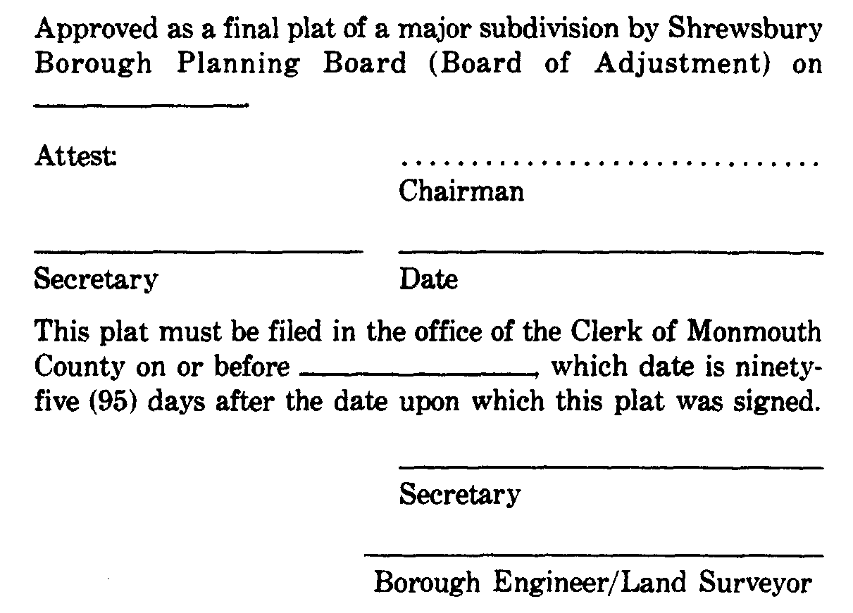
shall be endorsed on the plat, and the original reproducible thereof shall be provided to the Board by the applicant. Said original shall be signed by the Chairman and Secretary of the Board and the Borough Engineer (as to the Map Filing Law certification), after they receive a certification from the Administrative Office (Planning Board or Board of Adjustment Secretary) that all conditions of approval have been satisfied. After the signature, the plat shall be reproduced as provided for in 94-6.4G of this chapter, and the signed original shall be returned to the applicant for filing.
E. Filing of approved plat. If the applicant desires to proceed with a subdivision for which final approval has been granted, he shall file with the county recording officer a plat map drawn in compliance with the New Jersey Map Filing Law (N.J.S.A. 46:23-9.9 et seq.), as amended and supplemented, within ninety-five (95) days from the date upon which said plat was signed by the Planning Board Chairman and Secretary and Borough Engineer/Land Surveyor. The applicant shall, within one (1) week after filing the subdivision with the county recording officer, notify in writing the Borough Engineer and Borough Tax Assessor of the date of filing of the subdivision with the county recording officer and the case and sheet or page number for the filed map. A duplicate tracing of the filed map indicating thereof the filing date shall be obtained from the county recording officer by the Borough Clerk who shall distribute copies of the filed map to appropriate municipal officials. In the event that the subdivider fails to so file within the period allowed, the approval of the plat shall expire unless, prior to expiration, such time is extended by the Board for a period not to exceed ninety-five (95) days for good cause shown.
F. Final approval.
(1) Application for final subdivision approval shall be granted or denied within forty-five (45) days of submission of a complete application to the Planning Board Subdivision Committee or Board of Adjustment or within such further time as may be consented to by the applicant.
(2) Final approval of a major subdivision shall expire ninety-five (95) from the date of signing of the plat unless within such period the plats shall have been duly filed by the developer with the county recording officer. The Planning Board may, for good cause shown, extend the period of recording for an additional period not to exceed one hundred ninety
(190) days from the date of the signing of the plat. The Planning Board may extend the ninety-five-day or one-hundred-ninety-day period if the developer proves to the reasonable satisfaction of the Planning Board that the developer was barred or prevented, directly or indirectly, from filing because of delays in obtaining legally required approvals from other governmental or quasi-governmental entities and that the developer applied for and diligently pursued the required approvals. The length of the extension shall be equal to the period of delay caused by the wait for the required approvals, as determined by the Planning Board. The developer may apply for an extension either before or after the original expiration date. [Amended 12-13-1993 by Ord. No. 670]
(3) No subdivision plat shall be accepted for filing by the county recording officer until it has been approved by the Planning Board as indicated on the instrument by the signature of the Chairman and Secretary of the Planning Board or a certificate has been issued pursuant to N.J.S.A. 40:55D-47, 40:55D-50, 40:55D-56, 40:55D-61, 40:55D-67 or 40:55D-76. The signatures of the Chairman and Secretary of the Planning Board shall not be affixed until the developer has posted the guaranties required pursuant to N.J.S.A. 40:55D-53 and � 94-7.1 of this chapter. If the county recording officer records any plat without such approval, such recording shall be deemed null and void, and upon request of the borough, the plat shall be expunged from the official records. [Added 12-13-1993 by Ord. No. 670]
(4) It shall be the duty of the county recording officer to notify the Planning Board in writing within seven
(7) days of the filing of any plat, identifying such instrument by its title, date of filing and official number. [Added 12-13-1993 by Ord. No. 670]
G. Effect of final approval. [Amended 12-13-1993 by Ord. No. 670]
(1) The zoning requirements applicable to the preliminary approval first granted and all other rights conferred upon the developer pursuant to N.J.S.A 40:55D- 49, whether conditionally or otherwise, shall not be changed for a period of two
(2) years after the date on which the resolution of final approval is adopted, provided that in the case of a major subdivision, the rights conferred by this section shall expire if the plat has not been duly recorded within the required time period. If the developer has followed the standards prescribed for final approval and, in the case of a subdivision, has duly recorded the plat as required in N.J.S.A 40:55D-54, the Planning Board may extend such period of protection for an extension of one (1) year but not to exceed three (3) extensions. Notwithstanding any other provisions of N.J.S.A. 40:55D-1 et seq., the granting of final approval terminates the time period of preliminary approval pursuant to N.J.S.A. 40:55D-49 for the section granted final approval.
(2) In the case of a subdivision for a residential cluster of fifty (50) acres or more or conventional subdivision of one hundred (150) acres or more, the Planning Board may grant the rights referred to in Subsection FM above for such period of time, longer than two (2) years, as shall be determined by the Planning Board to be reasonable taking into consideration the number of dwelling units and nonresidential floor area permissible under final approval, economic conditions and the comprehensiveness of the development. The developer may apply for thereafter and the Planning Board may thereafter grant an extension of final approval for such additional period of time as shall be determined by the Planning Board to be reasonable, taking into consideration the number of dwelling units and nonresidential floor area permissible under final approval, the number of dwelling units and nonresidential floor area remaining to be developed, economic conditions and the comprehensiveness of the development.
(3) Whenever the Planning Board grants an extension of final approval pursuant to Subsection F(1) or (2) above and final approval has expired before the date on which the extension is granted, the extension shall begin on what would otherwise be the expiration date. The developer may apply for the extension either before or after what would otherwise be the expiration date.
(4) The Planning Board shall grant an extension of final approval for a period determined by the Board but not exceeding one (1) year from what would otherwise be the expiration date if the developer proves to the reasonable satisfaction of the board that the developer was barred or prevented, directly or indirectly, from proceeding with the development because of delays in obtaining legally required approvals from other governmental entities and that the developer applied promptly for and diligently pursued these approvals. A developer shall apply for the extension before what would otherwise be the expiration date of the final approval or the 91st day after the developer receives the last legally required approval from other governmental entities, whichever occurs later. Am extension granted pursuant to this subsection shall not preclude the Planning Board from granting an extension pursuant to Subsection FM or (2) above.
H. Combined preliminary and final major subdivision approval.
(1) An applicant may request and the Planning Board may consent to accept an application for development for combined preliminary and final major subdivision approval, provided that:
(a) The proposed development is not to be constructed in sections or stages.
(b) The applicant pays the application fees and provides all submissions required for both preliminary and final applications.
(c) Any notice of hearing requirements applicable to the preliminary plat stage is complied with.
(d) The applicant consents to the time limits for action by the Board to be the greater of the limits set for either preliminary or final approval.
(e) The Board is satisfied that the scope of the project is not so large or so complex as to require the additional review time which separate applications would provide.
(2) Any approval granted by the Planning Board or such combined application shall confer upon the applicant all the rights set forth in this section for final approval.
I. Display of final plat. The subdivider or his agent shall keep a clear and legible cop of the approved final plat in plain view in a prominent location in his offices and/or sales rooms from which sales in the approved subdivisions are made so that prospective purchasers may have the opportunity to learn the special conditions, if any, under which approval was given.

