
E. Time limit and effect of approval. Minor site plan approvals shall be granted or denied within forty-five (45) days of the date of submission of a complete application to the administrative officer (Planning Board Secretary) or within such further time as may be consented to by the applicant. Failure of the Planning Board to act within the period prescribed shall constitute minor site plan approval, Whenever review or approval of the application by the Monmouth County Planning Board is required by N.J.S.A. 40:27-6.6, the Borough Planning Board shall condition any approval that it grants upon timely receipt of a favorable report on the application by the Monmouth County Planning Board or approval by the Monmouth County Planning Board by its failure to report thereon within the required time period. The zoning requirements and general terms and conditions, whether conditional or otherwise, upon which minor site plan approval was granted, shall not be changed for a period of two (2) years after the date of the minor site plan approval. The Planning Board shall grant an extension of this period for a period determined by the Board but not exceeding one (1) year from what would otherwise be the expiration date if the developer proves to be the reasonable satisfaction of the Board that the developer was barred or prevented, directly or indirectly, from proceeding with the development because of delays in obtaining legally required approvals from other governmental entities and that the developer applied promptly for and diligently pursued the required approvals. A developer shall apply for this extension before what would otherwise be the expiration date or the 91st day after the date on which the developer receives the last of the legally required approvals from the other governmental entities, whichever occurs later. [Amended 12-13-1993 by Ord. No. 670]
A. Required documents. Prior to issuance of a certificate of completeness, the administrative officer (Planning Board or Board of Adjustment Secretary) shall determine that the following have been submitted in proper form. The administrative officer may schedule a variance for public hearing upon submission of the items in Subsection AM through (3):
(1) Required application fees as set forth in 94-3.14 of this chapter.
(2) Fifteen (15) copies of a plan drawn to scale, showing the location and dimensions of the property and any structures, including buildings, pools, fences and parking areas, and indicating any proposed changes.
(3) Proof of service of notice in conformance with § 94-3.3D of this chapter.
B. Conditions of approval. Any approval of an application for development for a variance granted by the municipal agency shall be subject to the following conditions being satisfied prior to the issuance of a development permit:
(1) Payment of any outstanding real estate taxes and property improvement assessments.
(2) Publication of a notice of the decision by the administrative officer (Planning Board Secretary or Board of Adjustment Secretary) within the time set forth in § 94- 3.3E of this chapter.
(3) Any other conditions which may be imposed by the municipal agency or which may be required by federal, state or local law.
(4) A condition setting forth the time within which all conditions must be satisfied in § 94-3.3F of this chapter.
A. Required documents. Prior to issuance of a certificate of completeness, the Planning- Board Subdivision Committee shall determine that the following has been submitted in proper form. The Subdivision Committee may recommend a preliminary plat of a major subdivision for public hearing upon submission of the items in Subsection AM through (8):
(1) The Borough Engineer's report.
(2) A copy of the application for granting of a CAFRA permit, where required and if submitted.
(3) An application for a New Jersey Department of Environmental Protection wetlands permit, where required.
(4) Other submittals which may be required by the Planning Board, Board of Adjustment or federal, state or municipal law,
(5) The application for development for a preliminary plat of a major subdivision shall include a request for the granting of any variances required.
(6) Required application fees as set forth in § 94-3.14 of this chapter.
(7) Thirty-three (33) copies of a plat and attachments meeting the requirements set forth below. [Amended 12-13-1993 by Ord. No. 6701
(8) Thirty (30) copies of a completed application form.
(9) Proof of service of notice in conformance with § 943.3D of this chapter.
A.1 [Added 11-13-1995 by Ord. No. 708; amended 8-3-1998 by Ord. No. 751] Planned developments. Except as provided in subparagraph 8 of this subsection A.1, subdivisions for or within planned developments shall conform to the requirements for conventional subdivision plats in accordance with the requirements of Chapter 94, Zoning and Land Development, as written and as the same may be hereafter amended, as well as to the requirements for planned developments. The following additional requirements shall be satisfied prior to preliminary approval of the planned development:
(1) The staging proposals for any planned development shall ensure that each stage shall provide for completion of all streets, utilities and services necessary for the section whether located within or outside the section.
(2) The Planning Board may authorize a greater concentration of density or intensity within a stage but only where offset by a lesser concentration in any completed prior stages or offset by an appropriate reservation of open space on the remaining land by grant of easement or covenant in favor of the municipality.
(3) The legal documents proposed to provide for deed restrictions, cross access agreements and cross maintenance agreements have been submitted and found to satisfactorily provide for the public's interests.
(4) All open space created shall be set aside as a separate parcel and maintained for the benefit of the owners and/or residents of the development in accordance with N.J.S.A. 40:55D-43.
(5) Any areas designated as wetlands or wetland buffers shall be deed restricted except for those lands for which state approval for development has been granted.
(6) The Planning Board shall determine the appropriateness of proposed dedications of open space prior to granting subdivision approval. Unless dedicated for public use, all open space parcels shall be owned and maintained by organizations established for those purposes.
(a) The developer shall provide for an organization pursuant to N.J.S.A. 40:55D-43 for the ownership and maintenance of open space created under a planned development.
(b) Such organization shall not be dissolved and shall not dispose of any open space, by sale or otherwise, except to an organization conceived and established to own and maintain the open space for the benefit of such development, and thereafter such organization shall not be dissolved or dispose of any of its open space without first offering to dedicate the same to the municipality.
(c) Unless the subdivision option provided in Section 94-10.6A(5)(h) pertaining to the property located in the R-113 zone is elected, all owners of property within a planned development shall be required to become members of the Homeowners Association charged with ownership and maintenance of open space and other common facilities, and the deeds for all properties as to which the owners must become members of the Homeowners Associations shall include a provision requiring such membership in the Homeowners Association, which requirement shall pass from owner to owner as a deed restriction.
(d) The legal documents proposed in the establishment of the required Homeowners Association shall have been submitted and found to conform to the objectives of the plans and proposals for the planned development and the intent of this chapter.
[1] The enabling declaration shall set forth the developer's intent to charge an association with certain responsibilities, including the covenants, which set forth the purchaser's responsibilities and obligations including the provisions for ownership and management of the common areas, the establishment of association assessments as a lien against all lots, the rights of members, including voting rights, the basis for assessments, the basis for enforcement of covenants by the association and the process of amendments.
[2] The articles of incorporation shall establish the association, the name and address of the association, the name and address of principal officers at the time of incorporation and the purpose and powers of the association. It shall set forth terms of membership and voting rights, create the initial board of directors, establish procedures for dissolution, the duration of the association in the absence of dissolution, the basis for amendments to the articles of incorporation and the severability of provisions.
[3] The bylaws shall set forth the meeting of the association, the basis for a quorum, provisions for vote by proxy and the notice of meetings. Bylaws shall set forth the terms of office for the board of directors, the composition of the board, the method of nomination, the method of election and the handling of resignations, removals, vacancies and compensation, as well as the conduct of board meetings. They shall also set forth the power and duties of the board. The officers, their means of election, terms of office and their duties shall be described. The committees required or the basis for their establishment shall be defined. The fiscal year shall be established, the indemnification of officers shall be described, and the basis for amendment shall be set forth.
[4] The proposed form of deed clause referring to the declaration and clarifying the title to common property adjacent to a lot.
[5] An information brochure designed to help ensure that all purchasers are informed of the association. It shall restate in clear text the relationship between the association, the purchaser and the developer. It shall cover the major elements of common area identification, ownership and use, the structure of the association, dues, officer and director selection and election, architectural controls, liens, annexation, dissolution and other areas.
(e) The plat shall contain: specifics of the enabling declaration dealing with the title to the common property; the granting of easements of enjoyment; the designation of areas dedicated for use by the general public; the designation of areas conveyed or intended to be conveyed to an association; and the granting of easements, covenants and restrictions establishing, fixing and apportioning responsibility for the maintenance of common property in the event the subdivision option provided in Section 94-10.6A(5)(h) is exercised.
(f) Any condominium or Homeowners Association filings with the New Jersey Department of Community Affairs shall also be filed with the Planning Board.
(7) Residential clusters shall conform to the following requirements:
(a) Each cluster shall be restricted to one (1) type or types of land used housing type in a contiguous group.
(b) The total number of dwelling units, or lots for single-family dwellings, shall not exceed the allowable density multiplied by the tract area to be improved for residential use plus any open space set aside for residential use.
(c) Building lots shall conform to the requirements for the alternative zone as if developed in that zone and shall maintain continuing compliance with said zone requirements.
(d) Developed open space parcels shall be designed to accommodate pedestrian ways of not less than ten (10) feet in width, which may include a four (4) foot wide paved, graveled, stoned or other suitable surfaced walkway, and recreation sites of not less than two thousand five hundred (2,500) square feet in area.
(8) In the event the subdivision option provided in Section 94-10.6A(5)(h) pertaining to property located in the R-IB zone is elected and provided all other requirements for land development are met and a General Development Plan is approved, the requirements for conventional subdivision plats otherwise set forth in Chapter 94, Zoning and Land Development shall be waived by the Board.
B. Plat requirements.
(1) [Amended 12-13-1993 by Ord. No. 670] General requirements. All plats containing proposals or designs for drainage, streets and subdivision layouts shall be prepared by a professional engineer licensed to practice in the State of New Jersey and shall bear the address, signature, embossed seal and license number of said professional engineer. The preliminary plat shall be based on a current certified land survey certified to the subdivider and shall be drawn at a scale of not less than thirty (30) feet to the inch for subdivisions and shall show or be accompanied by the information specified below:
(2) Title block. The title block shall appear on all sheets and include:
(a) The title to read "Preliminary plat - major subdivision."
(b) The name of subdivision, if any.
(c) The Tax Map sheet, block and lot number(s) of the tract to be subdivided as shown on the latest Borough Tax Map, the date of which shall also be shown.
(d) The date of the original and all revisions.
(e) The names and addresses of the owner and subdivider so designated.
(f) The name(s), signature(s), address(es) and license number(s) of the engineer and/or land surveyor who prepared the map. (The plat shall bear the embossed seal of said engineer and land surveyor.)
(3) A key map [at a scale of not less than one (1) inch equals one thousand (1,000) feet] showing the location of the tract to be subdivided, with reference to surrounding areas, existing streets which intersect or border the tract, the names of all such streets and any zone boundary or borough boundary which is within five hundred (500) feet of the subdivision.
(4) A schedule shall be placed on the map indicating the acreage of the tract, the number of lots, the zone district, the minimum required lot areas, setbacks, yards and dimensions.
(5) Zone district boundaries, borough borders and the names of all owners, lot and block numbers and property lines of parcels within two hundred (200) feet of the land to be subdivided, including properties across the street, as shown by the most recent records of the borough or of the municipality of which the property is a part.
(6) The preliminary plat shall be based on a current certified boundary survey as required above with sufficient lines of the adjoining tracts surveyed to establish any overlap or gap between the adjoining boundary lines and the boundary lines of the tract in question and prepared in accordance with N.J.A.C. 13:40-5.1, Preparation of Land Surveys. The date of the survey and the name of the person making the same shall be shown on the map.
(7) Contours. Existing one-foot-interval contours based on United States Coast and Geodetic Survey datum (MSL=O) shall be shown extending a minimum of one hundred (100) feet behind the boundary of the tract in question and shall be certified by a New Jersey licensed land surveyor or professional engineer as to accuracy, except that where the slopes exceed five percent (5%), a two-foot interval may be used, and if the slopes exceed ten percent (10%), a five-foot interval is permissible. The source of elevation datum base shall be noted. If contours have been established by aerial photography, a check profile shall be made on the boundary line of the tract and certified by a New jersey licensed land surveyor.
(8) All existing streets, public easements, watercourses, floodways and flood hazard areas within the proposed subdivision and within two hundred (200) feet of the boundaries thereof, including both the width of the paving and the width of the right-of- way of each street within two hundred (200) feet of the subdivision.
(9) All existing structures, an indication of those which are to be destroyed or removed and the front, rear and side yard dimensions of those to remain.
(10) The boundaries, nature, extent and acreage of wooded areas and other important physical features, including swamps, bogs and ponds within the proposed subdivision and within two hundred (200) feet thereof.
(11) The layout of the proposed subdivision drawn in compliance with the provisions of this chapter.
(12) All proposed public easements or rights-of-way and the purposes thereof and proposed streets within the proposed subdivision. The proposed streets shall show the right-of-way and proposed pavement width.
(13) The existing system of drainage of the subdivision and of any larger tract of which it is a part, together with information on how it is proposed to dispose of surface drainage.
(14) The acreage of the drainage area (or areas) of each natural or man-made watercourse traversing the subdivision, including the area within the subdivision and the area upstream from the subdivision. "
(15) All proposed lot lines and areas of all lots in square feet. The areas and dimensions specified should be accurate to within minus zero percent (-O%) and plus four percent (+4%). [For example, a lot line specified as two hundred fifty (250) feet long should not be less than two hundred fifty (250) feet but may be as long as two hundred sixty (260) feet.]
(16) The North arrow and basis therefor and written and graphic scales.
(17) Preliminary utility layouts showing methods of connection and sources of service. Prior to public hearing for a preliminary subdivision plat, the developer shall provide written certification that he has contacted the involved servicing utility companies and has received their detailed specific installation standards. It will be the developer's responsibility to then integrate the various design standards and achieve optimum coordinated design.
(18) The proposed location and area, in acres or square feet, of all proposed common open space areas.
(19) The types and locations of all stakes, marks or flagged points, if any, placed on the property to aid in on-site inspections. The Planning Board may require that the marks or stakes, as a minimum, be placed at the intersection of all lines of the tract boundary with existing streets, at the center of all culs-de-sac, at all internal street intersections, along street tangents, at intervals not exceeding five hundred (500) feet and at such additional locations as the Planning Board may deem necessary. The locations indicated on the plat shall be accurate within plus or minus ten (10) feet. Any traverse lines cut out and/or marked on the site shall be shown on the plan. If such on-site points, as above discussed. have not been established at the time of submission of a tentative plat, the Planning Board may give the subdivider fifteen (15) days' notice of the date of any proposed site inspection by the Board, so the points can be set.
(20) The tentative plat shall show, on the property to be subdivided and within two hundred (200) feet of that property, all existing paper streets, dirt roads, paved streets, curbs, manholes, sewer lines, water and gas pipes, utility poles, ponds, swamps and all other topographical features of a physical or engineering nature.
(a) The preliminary plat shall show or be accompanied by a preliminary grading and drainage plan which shall show locations of all existing and proposed drainage swales and channels, retention-recharge basins, the scheme of surface drainage and other items pertinent to drainage, including the approximate proposed grading contours at one-foot intervals, except that if slopes exceed five percent (5%), a two- foot interval may be used, and if they exceed ten percent (10%), a five-foot interval is permissible. Datum shall be United States Coast and Geodetic Survey datum (MSL=O), and the source of datum shall be noted.
(b) The plan shall outline the approximate area contributing to each inlet.
(c) All proposed drainage shall be shown with preliminary pipe type and sizes, invert elevations, grades and direction of flow. The direction of flow of all surface waters and all watercourses shall be shown.
(d) The preliminary grading and drainage plan shall be accompanied by drainage calculations made in accordance with standards set forth in § 94-8.39.
(22) Preliminary off-site drainage plan. The preliminary plat shall also be accompanied by a preliminary off-site drainage plan prepared in accordance with the following standards:
(a) The plan shall consist of an outline of the entire drainage basin in which the property to be subdivided is located. The terminus of the basin and existing ground contours or other basis for determining basin limits shall be shown.
(b) Pertinent off-site existing drainage, which receives or discharges runoff from or onto the site, shall be shown with elevations of inverts, pipe types and sizes or other appropriate physical data for open or nonpipe conduits.
(c) To the extent that information is available and may be obtained from the County or Borough Engineer(s), any existing plans for drainage improvements shall be shown.
(d) In the event that a temporary drainage system is proposed, tentative plans of that system shall be shown.
(23) Boring logs. Unless the Borough Engineer shall determine that fewer boring logs are required or that some or all of the boring logs may be deferred to the final plat stage, the preliminary plat shall be accompanied by a set of boring logs and soil analyses for borings made in accordance with the following requirements:
(a) Borings taken shall be between January 1 and April 30 and spaced evenly throughout the tract.
(b) One (1) boring not less than fifteen (15) feet below the proposed grade or twenty (20) feet minimum depth shall be made for every five (5) acres, or portion thereof, of land within a tract where the water table is found to be ten (10) feet or more below the proposed or existing grade at all boring locations.
(c) One (1) additional boring shall be made per acre, or portion thereof, in those areas where the water table is found to be less than ten (10) feet below the proposed or existing grade.
(d) In addition to the above, in those areas where the water table is found to be five (5) feet or less below the existing or proposed grade, two (2) additional borings per acre, or portion thereof, will be required. If construction of homes with basements is contemplated, at least one (1) boring will be located on each lot within the building setback lines.
(e) Boring logs shall show soil types and characteristics encountered, groundwater depth, the methods and equipment used, the name of the firm making the borings and the name of the person in charge of the boring operation. The boring logs shall also show surface elevations to the nearest one-tenth (0.1) of a foot.
(f) Based on the borings, the preliminary plat shall clearly indicate all areas having a water table within two (2) feet of the existing surface of the land, or within two (2) feet of proposed grade, or all areas within which two (2) feet or more of fill is contemplated or has previously been placed.
(24) The location, dimensions, area and disposition of any park and recreation areas shall be shown and noted on the preliminary plat and shall be subject to the approval of the Planning Board.
(25) Sectionalization and staging plans. The preliminary sectionalization and staging plan showing the following:
(a) If the subdivision is proposed to be filed for final approval in sections, the plan shall show each such section and the anticipated date of filing for each section. The staging of the various sections in the subdivision shall be such that if development of the subdivision were to be discontinued after the completion of any section, the developed portion of the subdivision would be provided with adequate street drainage and utility systems. The size and staging of the section in a subdivision shall be established to promote orderly development and shall be subject to the approval of the Board.
(b) The sectionalization and staging plan shall identify for each lot or group of lots in the subdivision those improvements that will be completed prior to application for certificates of occupancy. The plan should demonstrate that the staging of construction will minimize adverse effects upon occupied buildings in the subdivision and adjoining properties.
(26) If the Planning Board or Board of Adjustment, Shade Tree Commission or Environmental Commission determines that existing trees located on the site may have an effect on the proper layout of the subdivision, it may be required that the location, caliper and type be shown on the plat for the following(a) Living deciduous trees having a trunk of four (4) inches diameter or more measured at four (4) feet above grade.
(b) All living coniferous trees having a trunk of four (4) inches or more diameter measured at four (4) feet above grade.
(c) All living dogwood (Cornus florida) or American Holly (Ilex opaca) trees having a trunk of one (1) inch or greater diameter at four (4) feet above grade.
(d) All native laurel (Kalmia latifolia) shrubs having a root crown of three (3) inches or greater measured at the soil or surface level.
(27) The location of proposed depressed pedestrian ramps and other facilities for the handicapped.
(28) Such other information as the Board and/or Borough Engineer may require or request during the review of the preliminary plat.
C. Conditions of approval.
(1) Any approval of an application for development for a preliminary plat of a major subdivision by the Planning Board or Board of Adjustment shall be subject to the following conditions being satisfied prior to the signing of the plat:
(a) Submission of additional prints of the plat and attachments for distribution, if required.
(b) Preliminary Monmouth County Planning Board approval, if not previously granted.
(c) Preliminary Northeast Monmouth County Regional Sewerage Authority approval, if not previously granted.
(d) Publication of the decision of the Board by the Administrative Officer (Planning Board or Board of Adjustment Secretary) within the time set forth in § 94-3.3E of this chapter.
(e) Any other conditions which may be imposed by the Board of may be required by federal. state, county or municipal law.
(f) A condition setting forth the time within which all conditions must be satisfied as described in § 943.3F of this chapter.
(2) The Board may also condition its preliminary approval upon the applicant providing for certain revisions or additions on the final plat submission.
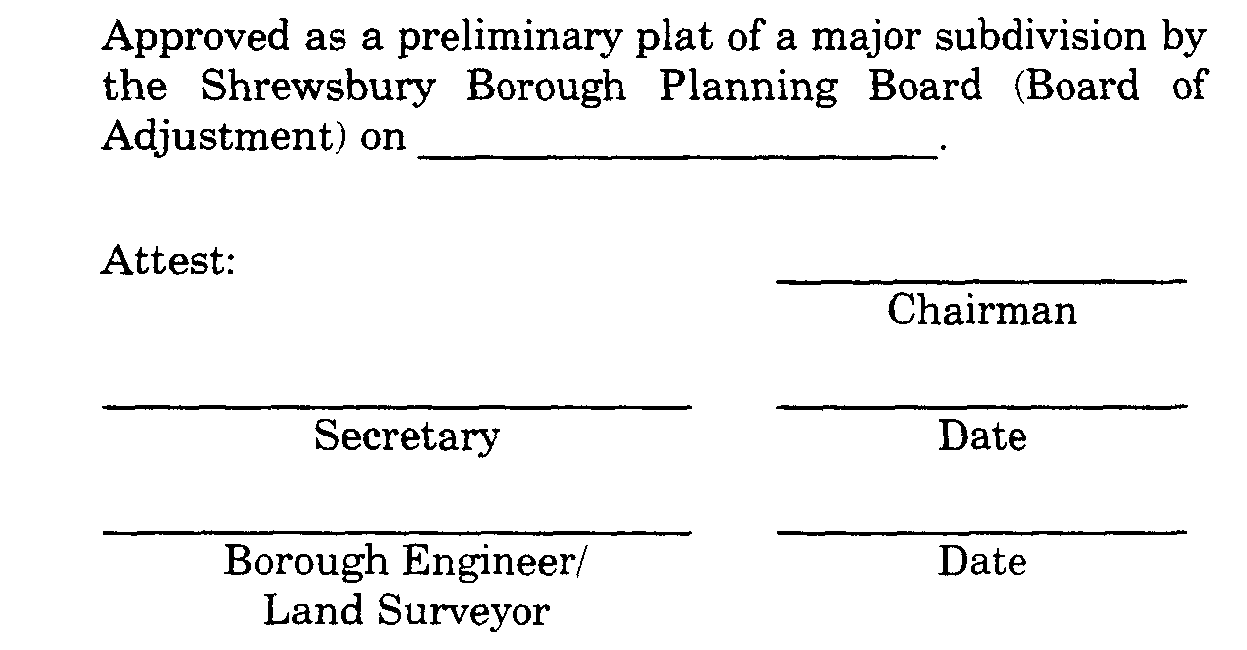
D. Certification. In the event that the application for development for a preliminary plat of a major subdivision is approved, a certificate to that effect in the following form shall be endorsed on the preliminary plan, and the original reproducible thereof shall be provided to the Board by the applicant. Said original shall be signed by the Chairman and Secretary of the Board after they receive certification from the administrative officer (Planning Board Secretary) that all conditions of approval have been satisfied. After signature, the preliminary plat shall be reproduced as provided for in § 94-6.4G of this chapter, and the signed original shall be returned to the applicant.
E. Time limits for preliminary approval.
(1) Upon submission of a complete application to the administrative officer (Planning Board Secretary) for a subdivision of ten (10) or fewer lots, the Planning Board shall grant or deny preliminary approval within forty-five (45) days of the date of such submission or within such further time as may be consented to by the developer. Upon submission of a complete application to the administrative officer (Planning Board Secretary) for a subdivision of more than ten (10) lots, the Planning Board shall grant or deny preliminary approval within ninety-five (95) days of the date of such submission or within such further time as may be consented to by the developer. Otherwise, the Planning Board shall be deemed to have granted preliminary approval of the major subdivision.
(2) Approval of a preliminary plat shall confer upon the applicant the rights set forth in N.J.S.A. 40:55D-49 and Subsection F of this section.
F. Effects of preliminary approval.
(1) [Amended 12-13-1993 by Ord. No. 6701 Preliminary approval of a major subdivision pursuant to N.J.S.A 40:55D-48 shall, except as otherwise provided herein, confer upon the applicant the following rights for a three-year period from the date on which the resolution of preliminary approval is adopted:
(a) That the general terms and conditions on which preliminary approval was granted shall not be changed, including but not limited to use requirements; layout and design standards for streets, curbs and sidewalks, lot size, yard dimensions and off- tract improvements, except that nothing herein shall be construed to prevent the borough from modifying by ordinance such general terms and conditions of preliminary approval as relate to public health and safety.
(b) That the applicant may submit for final approval on or before the expiration date of preliminary approval the whole or a section or sections of the preliminary subdivision plat.
(c) That the applicant may apply for and the Planning Board may grant extensions of such preliminary approval for additional periods of at least one (1) year, but not to exceed a total extension of two (2) years, provided that if the design standards have been revised by ordinance, such revised standards shall govern.
(2) In the case of a subdivision of fifty (50) acres or more, the Planning Board may grant the rights referred to in Subsection F(1)(a), (b) and (c) above for such period of time, longer than three (3) years, as shall be determined by the Planning Board to be reasonable, taking into consideration the number of dwelling units and nonresidential floor area permissible under preliminary approval, economic conditions and the comprehensiveness of the development. The applicant may apply for thereafter and the Planning Board may thereafter grant an extension to preliminary approval for such additional period of time as shall be determined by the Planning Board to be reasonable, taking into consideration the number of dwelling units and nonresidential floor area permissible under preliminary approval, the potential number of dwelling units and nonresidential floor area of the section or sections awaiting final approval, economic conditions and the comprehensiveness of the development, provided that if the design standards have been revised, such revised standards shall govern.
(3) Whenever the Planning Board grants an extension of preliminary approval pursuant to Subsection F(1)(c) or (2) above and preliminary approval has expired before the date on which the extension is granted, the extension shall begin on what would otherwise be the expiration date. The developer may apply for the extension either before or after what would otherwise be the expiration date. [Added 12-13-1993 by Ord. No. 670]
(4) The Planning Board shall grant an extension of preliminary approval for a period determined by the Board but not exceeding one (1) year from what would otherwise be the expiration date if the developer proves to the reasonable satisfaction of the Board that the developer was barred or prevented, directly or indirectly, from proceeding with the development because of delays in obtaining legally required approvals from other governmental entities and that the developer applied promptly for and diligently pursued the required approvals. A developer shall apply for the extension before what would otherwise be the expiration date of the preliminary approval or the 91st day after the developer receives the last legally required approval from other governmental entities, whichever occurs later. An extension granted pursuant to this subsection shall not preclude the Planning Board from granting an extension pursuant to Subsection F(1)(c) or (2). [Added 12-13-1993 by Ord. No. 670]
G. Improvements not to be installed. Approval of a preliminary plat shall not confer upon the developer the right to undertake any clearing, grading and/or to install any improvements prior to final plat approval unless it shall be determined by the Planning Board or Board of Adjustment and the Borough Engineer that such clearing, grading and/or installation of improvements would not hinder future development or create physical or aesthetic problems in the event that further development of the subdivision is not undertaken and that required inspection fees have been paid and adequate performance guaranties have been posted to provide for the cost to the borough of performing work that may be necessary to protect adjacent property owners and the public interest in the event that such clearing, grading and/or installation of improvement is not completed and/or further development of the subdivision is not undertaken. Such performance guaranties shall include, but are not limited to, the cost to the borough of providing erosion control facilities, seeding or otherwise stabilizing the site, drainage facilities necessary to protect off-tract acres from flooding, screening or fencing that may be required and all improvements to be undertaken which are within existing public rights-of-way of easements.

