
A. All plats, whether concept, minor, preliminary, final or general development plans, shall be submitted on drawing sheet sizes of either 8 1/2 by 13 inches, 15 by 21 inches, 24 by 36 inches or 30 by 42 inches.
B. All roadway plan and profile sheets shall be 24 by 36 inches.
C. Drawings shall be prepared at scales not to exceed the following:
(1) Concept plans: one inch equals 200 feet.
(2) Minor subdivision, preliminary subdivision, final subdivision, and general development plans: one inch equals 100 feet.
(3) Minor site plan, preliminary site plan, final site plan, roadway plan and profiles, grading, utilities, etc.: one inch equals 50 feet horizontal and one inch equals five feet vertical.
D. All drawings shall have a title block which shall include the following information:
(1) Name of subdivision.
(2) Name, address and license of the professional person who prepared the drawing.
(3) The title concept plan, minor subdivision, preliminary plat or final plat, as applicable.
(4) Date of the drawing.
(5) Drawing reference number.
(6) Section number or phase, if applicable.
(7) Scale of drawing.
E. Drawings shall also include the following:
(1) North arrow with reference meridian and graphic scale.
(2) Date of original drawing and date and nature of all subsequent revisions.
(3) Name and address of the owner and the applicant.
(4) Tax sheet, block and lot number(s).
(5) Key map showing the subdivision site, zone district, and its relation to surrounding areas, streets, highways and zone district boundaries.
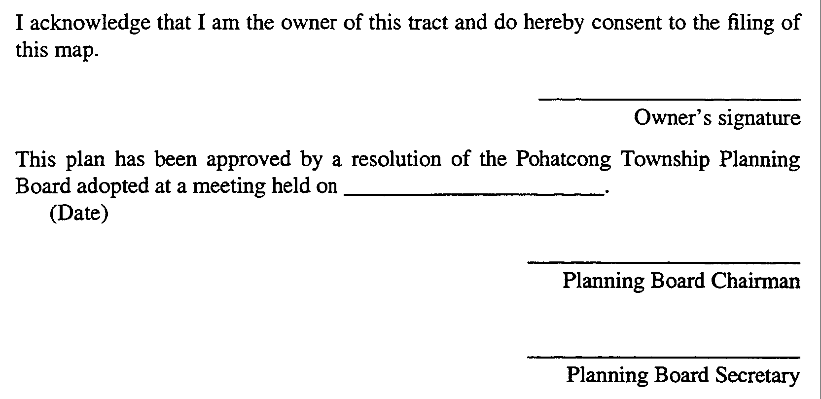
(6) The following certifications shall be provided on all plans, except concept plans:
F. All drawings shall be prepared by the appropriate professionals pursuant to the requirements of N.J.A.C. 13:40-7.1 et seq. entitled "Permissible Division of Responsibility in Submission of Site Plans and Major Subdivision Plats."
G. Preliminary and final subdivision and site plans and general development plans shall have a title sheet showing the following information:
(1) Name and address of the owner and applicant.
(2) Tax map sheet, block and lot number(s) and total area of tract.
(3) Zone district.
(4) Area of section being subdivided, if applicable.
(5) Area of tract within each zone district.
(6) Number of proposed lots, residential units and nonresidential building area and floor area.
(7) Key map showing the subdivision site and its relationship to the surrounding area, streets, zone districts and development phasing, if applicable.

