
In addition to the requirements established herein all subdivision plans shall comply with the following laws, standards and regulations:
4.1.1 All applicable statutory provisions
4.1.2 The Shelton Zoning Regulations, building and housing codes and other applicable laws.
4.1.3 The City's Comprehensive Plan of Development: Subdivisions shall be planned and designed in general conformity with any plan of development adopted by the Commission under Chapter 126 of the Connecticut General Statutes for the City or the neighborhood encompassing the subdivision, particularly with regard to
a) location and classification of streets,
b) sanitary sewer, water supply and drainage systems and service areas and
c) reservation of land for parks, recreation and open space.
4.1.4 The special requirements of these regulations and any rules of the Valley Health Department and/or appropriate State Agencies.
4.1.5 The rules of the State Department of Transportation if the subdivision or any lot contained therein abuts a State highway.
4.1.6 The standards and regulations adopted by the City Engineer and all Boards, Commissions, Agencies, and Officials of the City of Shelton.
4.1.7 Approval of a proposed subdivision may be withheld if the subdivision is not in conformity with the above guides on policy and purpose of these regulations established in Section 1.1 of these regulations.
Land which the Commission finds to be unsuitable for subdivision of development due to flooding, improper drainage, steep slopes, rock formations, adverse earth formations or topography, utility easements, or other features which will reasonably be harmful to the safety, health and general welfare of the present or future inhabitants of the subdivision and/or its surrounding areas, shall not be subdivided or developed unless adequate methods are formulated by the applicant and approved by the Commission, upon recommendation of the City Engineer, to solve the problems created by the unsuitable land conditions.
Proposed building lots shall be of such shape, size, location, topography, access and character as to be occupied and used for building purposes, whether single family houses, apartments, business or industrial as permitted by law, without danger to the health and safety of the occupants, the neighborhood or the public. Any proposed, at which is -found unsuitable for occupancy or building by reason of water or flooding conditions, topography, unsuitable soils or other conditions shall be combined with another contiguous lot that is suitable for or shall be marked "This is not an approved lot" on the Record Subdivision Map, until necessary .improvements to the lot have been made and approved by the Commission and a revised Record Subdivision Map has been submitted to and approved by the Commission. Proposed building lots shall also conform to the following additional standards as stated below. However, the Commission may approve lots which do not meet all of the requirements subject to identification of such lots and imposition of additional conditions, i.e. "Prior to the approval of any application for a certificate of Zoning Compliance and issuance of a building permit on Lots #_____, a detailed, engineered site plan complying with all requirements of Paragraph 3.2 and section 31 of the Zoning Regulations of the City of Shelton shall be prepared by a registered professional engineer for review and approval by the Planning and Zoning Commission. This site plan shall give specific attention to existing and proposed contours, grading, driveways, building locations, proposed retraining walls and embankments, on-site utility systems, storm drainage facilities, soil erosion control, significant landscaping features and other information deemed appropriate by the Commission."
4.3.1 Terrain: Proposed building lots shall be planned to make best use of the natural terrain, to preserve substantial trees, woods and water resources and to avoid extensive regarding. Each lot shall be capable of accommodating automobile access to a parking space or spaces on the lot by means of a driveway having a grade no greater than 12%.
4.3.2 Lot Size: Each lot shall conform to the current "Zoning Regulations of the City of Shelton, Connecticut", unless required by these Regulations to be larger in or der to accommodate onsite sewage disposal and/or water supply systems.
4.3.3 Lot Numbers: All lots shall be numbered beginning with the numeral "1" and shall continue consecutively throughout the entire subdivision with no omissions or duplications. No fractions and no prefixes or suffix such as "1A", "B2" or "CC" shall be used unless necessary for clarity in a subdivision. Adjoining subdivisions having the same title shall not duplicate the numbers used previously for the adjoining land. All lot numbers shall be conspicuous and centered in the approximate center of the lots.
4.3.4 Lot Lines: Insofar as practicable, the side lot lines of all lots shall be at right angles to the street on which the lot faces or shall be radial to the street line. It shall be the discretion of the Commission to refuse to permit municipal boundary lines to cross any lot, and in the event of such refusal, such boundary line shall be made to constitute one of the lot lines.
4.3.5 Lot Access: Where driveway access from a thoroughfare may be necessary for several adjoining lots, the Commission may require that such lots be served by a combined access drive in order to limit possible traffic hazard on such street. Where possible, driveways should be designed and arranged so as to, avoid requiring vehicles to back into traffic on principle thoroughfares. Furthermore, driveways should be designed so that safe sight distances are provided.
Streets shall be planned and designed to provide a safe and convenient system for the present and prospective traffic and to conform to the following standards:
4.4.1 Classification: All streets shall be classified as follows:
a. Thoroughfare: a street of considerable existing or potential continuity on which traffic past abutting lots will be dominant and serving as an artery for intercommunication among large areas of the City or serving as a feeder to a neighborhood.
b. Local Street: a street primarily providing access to abutting residential properties.
c. Commercial Street: a street giving direct access to or circulation within business or industrial areas.
d. Private Street: Upon written request of the applicant, the Commission may approve a proposed street as a permanent private street of the Commission finds that such street will not carry more traffic than is expected of a local street or a commercial street serving only abutting lots, that such street will not impair the orderly development of the neighborhood, that there will be safe and convenient circulation for vehicles and pedestrians -including emergency vehicles and that there will be suitable arrangements for maintenance and repair.
4.4.2 Right-of-way Width: Streets shall have the following minimum width of rightof-way according to their classification:
a. Thoroughfare: 60 feet
b. Local Street: 50 feet
c. Commercial Street: 60 feet
d. Private Street: 50 feet for residential areas; 60 feet for business and industrial areas.
e. Turnaround: 60 foot radius
4.4.3 Width of Payment: Streets shall be designed with the. following width of pavement centered between the street lines:
a. Thorouqhfare: 40 feet
b. Local Street: 30 feet
c. Commercial Street: 40 feet
d. Private Street:: 30 feet for residential areas; 36 feet for business and industrial areas.
e. Turnaround: 50 foot radius
4.4.4 Horizontal Alignment:
A. Radius of Curvature
The minimum radius of Curvature at the center line of streets shall be as follows:
1. Thoroughfare: 500 feet
2. Local Street: 150 feet
3. Commercial Street: 300 feet
4. Private Street: 150 feet for residential areas; 300 feet for Business and Industrial areas.
B. Length of tangents between reverse curves.
The Minimum tangents between reverse curves shall be provided as follows:
1. Thoroughfare: 300 feet
2. Local Street: 100 feet
3. Commercial Street: 200 feet
4. Private Street: 100 feet
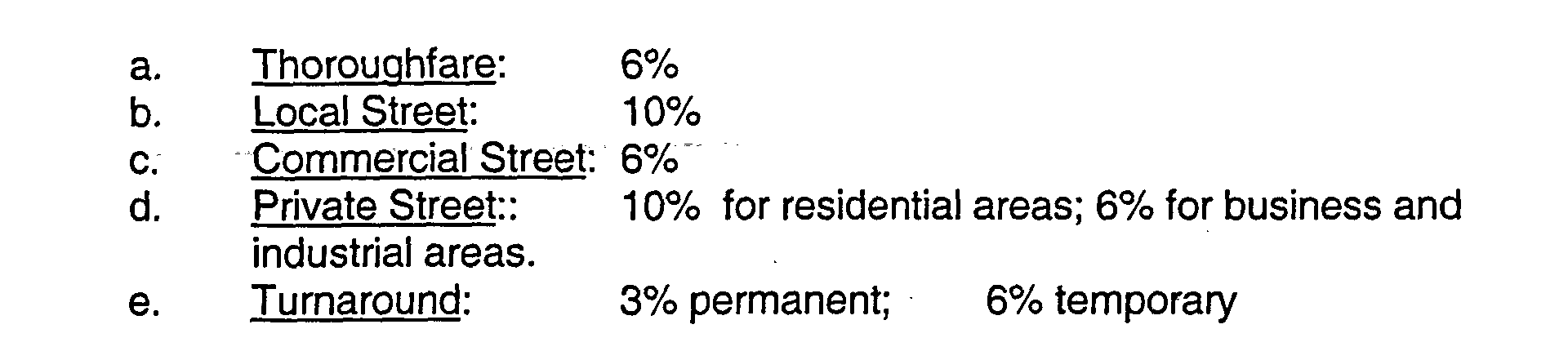
4.4.5 Grade: Streets should in general follow the contours of the land. The minimum grade for any street shall be 1.0% and the maximum grade shall not exceed the following:
4.4.6 Vertical Curves: Appropriate vertical curves shall be established on all streets and at street intersections to insure adequate sight distance in accordance with the classification of the street and good engineering practice. Where any street approached an intersection at a grade of 4% or more, a transition area, having a maximum grade of 2%, shall be provided for a minimum of 50 feet measured from the right-of-way line of the -street intersected.- The following minimum stopping sight distances shall be provided:
a. Thoroughfare: 350 feet
b. Local Street: 250 feet
c. Commercial Street: 250 feet
d. Private Street:: 250 feet
4.4.7 Intersections: The following standards shall apply to the street intersections:
a. No more than two streets shall intersect at one point. Intersections shall be spaced not less than 400 feet apart, except when in the opinion of the Commission conditions justify a variation from this requirement.
b. Streets shall intersect one another at as near to a right angle as is practical. No intersection shall be at an angle of less than 60 degrees.
c. At street intersections, property line corners shall be rounded by an arc having a minimum radius of 25 feet.
4.4.8 Street Lines: Street lines on each side of a proposed street shall be parallel or shall be concentric arcs, except at intersections and turnarounds designed in accordance with these regulations. No-street right-of-way shall be widened beyond minimum width specified in these Regulations for the purpose of securing additional street frontage for proposed lots. The boundary line between a private street and public street shall be clearly delineated.
4.4.9 Relation to Adjoining Areas: Proposed streets shall be planned in such a manner as to provide safe and convenient access to proposed lots and with due consideration for preserving desirable trees and natural features in the subdivision and for accomplishing an attractive layout and development of the land in the subdivision and in the neighborhood. Local streets and private streets in residential areas shall be planned to discourage through traffic but also to provide a safe and convenient system for present and prospective traffic in the subdivision and shall be planned where appropriate for continuation of existing streets in adjoining areas and for projection into adjoining properties when subdivided. The distance between intersections and connecting streets shall not be less than 400 feet nor more than 1 000 feet, except when in the opinion of the commission conditions justify a variations from this requirement.
a. When a subdivision proposes the continuation of an existing deadend street, it shall be-the full responsibility of the sub-divider to improve said street extension or connection; including, but not limited to, the removal of any temporary turnaround, the replacement of all curbs and driveway aprons, the replanting of all unpaved areas and the extension or connection of all other required improvements.
b. When a right-of-way for a future street or extension of a street is proposed on a subdivision Plan, the Commission may require the sub-divider to improve all or any portion of said street right-of-way.
4.4.10. Dead End Streets: No permanent dead end street shall be planned except when topography, soils, or other physical conditions make it impractical or undesirable to extend it or connect it with another proposed or existing street, or when traffic flow patterns will result in undesirable impacts on existing neighborhoods or when the City-wide street pattern does not require a connection and the peace and tranquility of existing or proposed development will be enhanced, as determined by the Commission. Notwithstanding the above, no permanent dead end street shall exceed in length the frontage of 10 lots per side; temporary dead end streets may exceed such length but shall not exceed a reasonable interim length for safe and convenient vehicular access, including emergency vehicles, as determined by the Commission. A turnaround shall be provided at the closed end of any dead end street serving one or-more building lots. A center island properly planted and with a radius of 20 feet shall be provided in any permanent dead end street as determined by the Commission. Land for a turnaround on a temporary dead end street may be provided in the form of a temporary easement bearing a note on the map "Easement for the temporary turnaround which automatically terminates upon extension of street.",
a. Said right-of-way shall be dedicated to the City or Otherwise permanently secured for the City by the sub-divider. Any necessary slope rights on abutting property shall be either temporarily or permanently secured for the City by the sub-divider, as required by the City Engineer.
b. The Commission may approve a permanent dead end serving more than ten (10) lots per side upon making the following findings:
1. Traffic safety and/or traffic flow will be adversely impacted by connecting the dead end road through to another existing or proposed road;
2. Access for emergency vehicles and personnel is not hindered by the design and specifications of the proposed permanent dead end;
3. The residential environment of the neighborhood is enhanced by a permanent dead end;
4. Under no circumstances shall the proposed dead end by capable of serving more than (30) building lots; and
5. The proposed permanent dead end shall not exceed a maximum length of two thousand (2,000) linear feet.
C. In deciding to approve an extended permanent dead end as set forth above, the Commission shall solicit and rely upon input from the Chief of Police as the local traffic authority, the service and Supply manager of the Board of Education with respect to school bus access, circulation and maneuvering, and the Fire Chief with respect to the potential impact on public safety concerns. The Commission may impose greater design standards, such as additional pavement width, flatter grades, larger diameter turn-around and/or easier geometry, as it deems necessary to overcome perceived potential access and public safety concerns.
4.4.11 Existing Streets: Where a tract of land to be subdivided has a frontage on an existing City street, adequate provision shall be made for slope and drainage rights and for the proper widening of the right-of-way of the existing street to 50 feet or to a greater width depending upon the classification given the street by the Commission.
4.4.12 Street Names: All proposed streets serving one or more lots shall be named and shall bear names which are appropriate to the character of the City and which do not duplicate or too closely approximate in spelling or sound existing street names in Shelton or any adjoining municipality. All street names shall be subject to the approval of the Commission.
4.4.13 Cross Section: Streets shall be designed with a cross section in accordance with the classification of the street and the "Standard Construction Details for Subdivision Improvements".
Monuments shall be located at all intersections and at all angles and points of curve of other critical points on street lines to enable a land surveyor to correctly stake out any lot or street in the subdivision.
The design of a[ storm drainage facilities shall be subject to the approval of the Commission and the City engineer. In general, storm water runoff shall be computed using the rational Formula with runoff factors approved by the City Engineer and in accordance with good engineering practice. Street drainage systems shall be designed to handle not less than two (2) inches of rainfall per hour, and cross culverts and similar systems not less than four (4) inches per hour. The following additions standards shall also apply:
4.6.1 Pipe and Ditches: Sufficient pipe shall be installed within the subdivision to carry existing water courses, other than rivers and large streams, and to drain the proposed street and streets which may reasonably be constructed at some future date on adjoining land which normally drains across the area of the proposed subdivision. If in its judgment there will be no substantial danger from soil erosion or danger to health and safety, the Commission may permit on lots of one (1) acre or larger the continuance of existing. water courses in their established courses and may permit the discharge of storm water in open ditches. Ditches and open water courses shall not be planned in the portion of the lot customarily used for private sewage disposal and/or water supply systems. In general, the storm drainage system shall be piped to a point 100 feet beyond the street line before being allowed to discharge into open channels. All ditches shall be of such size and all pipe shall be of such diameter (not less than 15 inches) as will in the judgment of the City Engineer be sufficient to carry properly the storm water expected to enter the ditch or pipe from the proposed subdivision and from the other properties when developed which normally drain across the area of the proposed subdivision. Design of all pipe sizes shall give due consideration to the entire drainage area, whether on site or offsite. The necessary size of the facility shall be subject to the approval of the City Engineer, based on City specifications and assuming conditions of maximum potential water shed development permitted by the Zoning Regulations. The City Engineer shall also study the effect of each subdivision on existing down stream drainage facilities outside the area of the subdivision. The City's drainage studies together with such other studies as shall be appropriate, shall serve as a guide to needed improvements. Where it is anticipated that the additional runoff incident to the development of the subdivision will overload an existing downstream drainage facility, the Commission may withhold approval of the subdivision until provision has been made for the improvement of said potential condition in such sum as the Commission shall determine. No subdivision shall be approved unless adequate drainage will be provided to an adequate drainage water course or facility. The minimum slope for 15 inch pipe shall be 1.0%. The minimum cover over pipe shall be four (4) feet from the invert but in no case shall be less than two (2) feet over the top of the pipe. Wherever possible street drainage pipes shall be located within ten (10) feet of the curb lines.
4.6.2 Manholes: Manholes shall be provided at each change on direction or grade of the pipe and shall not be spaced more than four hundred (400) feet apart.
4.6.3 Catch Basins: Catch basins shall be provided in order that surface water will not travel without interception more than four hundred feet on streets with grades up to and including 5% and not more than 300 feet on streets with grades over 5%.
4.6.4 Discharge: The discharge of all storm water from the subdivision shall be into suitable streams or rivers or into City or State Drains, ditches or other drainage facilities with adequate capacity to carry additional water. Where the discharge shall be into private property adjoining the proposed subdivision, proper easements and discharge rights shall be secured by the applicant for the City before approval of the Record Subdivision Map and acceptance of the drainage plan. N storm water shall be diverted from one watershed to another.
4.6.5 Headwalls and Culverts: Suitable headwalls shall be provided at the open end of any pipe. Culverts under streets shall be extended to the edge of the right-of-way of the street and shall have a minimum diameter of 18 inches.
Bridges, box culverts, deep manholes and other special structures shall be designed in accordance with good engineering practice. Bridges and box culverts shall be designed to carry the full width of required street pavement and at least four foot sidewalk on each side.
Easements, having a minimum width of twenty (20) feet or such greater width as may be required by the City Engineer, shall be provided for all storm water and sanitary sewer pipes which will not be installed in streets to be dedicated to the City. The easement shall be located so that the pipe is positioned five (5) feet from the boundary of such easement. Easements at least twenty (20) feet in width shall also be provided for the full width of the channel of any stream or drainage ditch which will carry drainage runoff from any proposed street, existing street, or streets which may be constructed in the future on unsubdivided land within the watershed. Easements shall also be provided, in locations deemed proper by the Commission or the City Engineer, for storm water and sanitary sewer pipes, water mains, or other utility lines that may need to be installed in the future.
Channel and building lines shall be provided along any major stream or river for the purpose of preventing encroachment upon and constriction of the natural water channel by buildings, filling operations or other facilities and construction. The width of the channel shall be based on sound engineering calculations anticipating long range storms and flow potentials and recognizing proper alignment and gradients of the channel. A note shall be placed on the record subdivision map explaining the channel and building lines and stating the restrictions against encroachment upon the channel in a manner approved by the Corporation Counsel.
When land to be subdivided includes land in Special Flood hazard Area or a Regulated Floodway, lots, streets, drainage and other improvements shall be designed in a manner to be capable of use without danger from flooding or flood related damages and be consistent with the need to minimize flood damage within the subdivision and the surrounding area. Such subdivisions shall also satisfy the following additional criteria:
4.10.1 Ordinance: All lots, streets, drainage and other improvements shall conform to the standards set forth in the Flood Plain Damage Prevention Ordinance of the City of Shelton.
4.10.2 Access: Streets shall be of such elevation or shall be suitably protected as to allow access during flood; and
4.10.3 Preservation: The commission may, when it deems it necessary for the health, safety or welfare of the present and future population of the area, and necessary to the conservation of water, drainage and sanitary facilities, prohibit the subdivision of any portion of the property which lies within the flood plain of any stream or drainage course. These flood plain areas shall be preserved from any and all destruction or damage resulting from clearing, grading or dumping of earth, waste material, or stumps, except at the discretion of the Commission.
4.10.4 All applications for subdivisions shall include base flood (1 00 year flood) elevation data.
4.10.5 The Commission may when it deems necessary for the health, safety or welfare of the present and future population of the area, and necessary to the conservation of water, drainage and sanitary facilities, prohibit the subdivision of any portion of the property which lies within the flood plain of any stream or drainage course. These flood plain areas shall be preserved from clearing, grading or dumping of earth, waste material, or stumps, except at the discretion of the Commission.

