
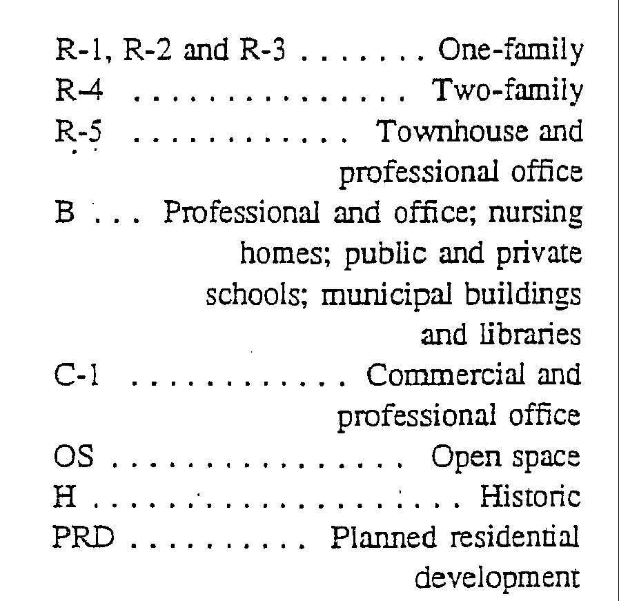
For the purpose of this title, the borough is divided into zones, designated as follows:
(Ord. 1173 (part), 1990: Ord. 1080 Ï 4, 1984: Ord. 820 Ï 3.100, 1963)
Said zones are -established and are bounded as shown on a map entitled "Building Zone Map of the Township of Glen Ridge Borough revised to March 12, 1990" and certified by the borough clerk, which accompanies and which with all explanatory matter thereon is made a part of this title. (Ord. 1173 (part), 1990: Ord. 1080 Ï 5, 1984: Ord. 820 Ï 3.200, 1963)
No land, structure, building or premises or part thereof shall be used, and no structure, building or part thereof shall be erected, altered or enlarged which is arranged, intended or designed to be used for any purpose other than one hereinafter listed as a permitted use in the zone in which such land, structure, building or premises is located. (Ord. 820 Ï 3.300, 1963)
All applications for building permits must be accompanied by a plot plan showing thereon the exact size, shape and location of any proposed building or addition and the location of all existing buildings and structures on the lot. Said plot plan shall be drawn to an indicated scale and shall be prepared by a licensed surveyor. In the case of alterations or additions, the building inspector may waive the requirements for the seal of a licensed surveyor on the plot plan if the location of the building or structure leaves no doubt in his or her mind that the regulations of the zone will be fulfilled. (Ord. 82O Ï 3.400, 1963)

